Gylis: A Comprehensive App for Fishing, Diving, and Traveling Enthusiasts
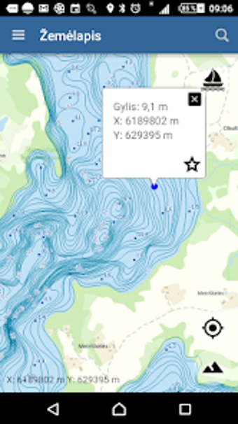
Gylis is a comprehensive app designed for fishing, ice fishing, diving, and traveling enthusiasts who want to explore Lithuania's water bodies. Developed by GIS-Centras, Gylis offers a complete list of 300 Lithuanian water bodies with their corresponding bathymetric plans. The app's bathymetric plans show the underwater topography of the water bodies, including contours and depth points, making it easier for users to navigate and explore the water bodies. The app's digital bathymetric plans are based on original data collected by the Climate and Water Research Laboratory of the Geological and Geographical Institute of the Nature Research Center, the Environmental Protection Agency, and the Internal Waterways Directorate.
Gylis offers several useful features, including the ability to find your location on the map, choose different map layers, mark your favorite spots on the map, find locations based on coordinates, measure lake depth profiles, length, and area, and track your route. The app is available for Android devices and requires an internet connection to function. With Gylis, users can easily explore Lithuania's water bodies and discover new fishing and diving spots.